Walks from Kefalas
Simply wander down the track and you'll be well on your way! Google Maps is really all you need, but it will take you just 10 minutes to reach one of a rich selection of published walks / guides, skirting the property.
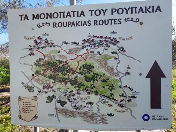
Roupakias Forest
Ancient footpaths criss-cross this charming forest
The Roupakias forest is situated at the bottom of the valley, surrounded by the villages of Kefalas, Xirosterni, Litsarda, Sellia, Souri and Likotinara. The villages are linked by ancient footpaths (clearly singposted) criss-crossing the forest
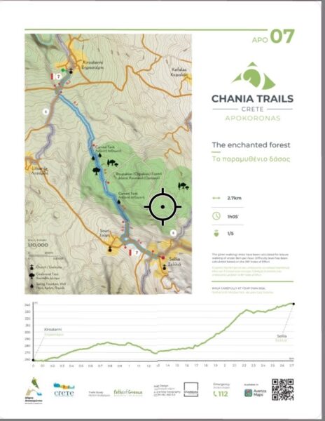
Chania Trails
Digital Maps for walks in the Apokoronas & Chania
The Region of Crete and the Municipality of Apokoronos presented at the facilities of the Provincial Press Institute (Agia Sophia Foundation) the development of the project for the identification,
12 interconnecting hiking routes in the Apokoronos, with a total length of 130 kilometers.
Three of the routes pass very close to the house:
APO 6: At the outskirts of the historic capital of Apokoronas

Discover on Foot
Walks in Apokoronas, Central and Western Crete
A colourful series of descriptive booklets featuring well-researched and maintained footpaths throughout the Apokoronas and beyond. Booklets include Vamos, Kalyves & Almyrida, Georgiopolis & Kournas, Chania, Rethemnon, Agia Galini, Plakias, Paleochora & Sougia, Myrtos
There is also a booklet with longer walks, complete with GPS points.